Clovelly to Hartland Quay
- Oct 9, 2024
- 5 min read
October 6, 2024, from the itinerary:
This section of Coast Path leads you through the stunning, contrasting landscapes of the Hartland Peninsula. You emerge from ancient woodland to follow the path through pastoral land on the open cliff tops and, on reaching Hartland Point, you turn to leave the valleys and woodland behind you as you suddenly enter a more barren and dramatic landscape along the rocky coast to Hartland Quay. Waterfalls crashing to the secluded rocky beaches of the Atlantic, wild flowers and seabirds all contribute to the sense of wilderness and distance from the busy settlements of the north coast.
Highlights:
Blackchurch Rock at Mouth Mill Cove, with its two natural archways.
Windbury Head Camp at the summit of Beckland Cliffs: this cliff top fort stands at 142 metres above sea level. It is thought to have been an Iron Age enclosure or hill fort and unfortunately much of it has been lost to coastal erosion.
Memories of war: the WWII memorial plaque to the Wellington bomber that crashed into nearby cliffs in the night in 1942 killing all of the crew, and the memorial to the ship the Glenart Castle which was torpedoed by a U-boat in 1918.
The extraordinary rock formations between Hartland Point and Hartland Quay.
Hartland Point with its lighthouse built in 1874 and fantastically named Tense Rocks just beyond the Point. You will also have spectacular views to South Wales and Lundy Island.
The views from Hartland Quay back along the rugged coast you’ve just walked and the route ahead to Bude.
Hartland Quay Museum which has fascinating displays of photographs, artefacts and documents of shipwrecks, smuggling, geology and coastal industries. Open: Easter week-October half term - 11.00-17.00.
Steve offered to come pick me up at the Hartland Quay Hotel and bring me back to the Corner B and B in Bideford. The 319 bus would have taken me 2+ hours, so this offer for a 30 minute return was gratefully accepted. It's one of the reason I brought the Champagne from Liphook and shlepped it that first day.
Anticipated stats: Moderate to Challenging. 10.9 miles 1,100 feet incline/1,525 feet decline
Actual stats: 10.2 miles, 1,475 foot incline/1,625 foot decline
Weather - a yellow warning of bad thunderstorms


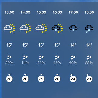


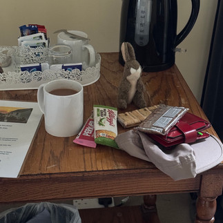
I wanted to get out of the hotel early to miss the rain, but reception was only open at 8:30. I had breakfast in my room while I was waiting (not included in rate).

I was quite annoyed when I realized this evening I forgot my onyx earrings at the hotel. They weren’t expensive ($12) but I bought them on a trip to India several years ago and was sorry to lose them:( I guess that’s an excuse to get some new travel earrings….
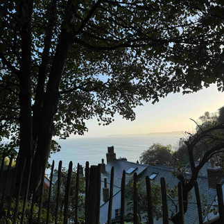
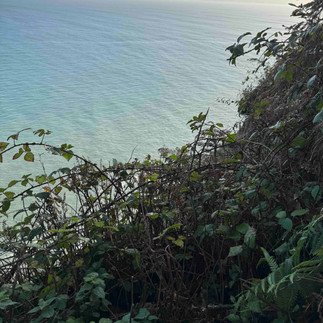
Even with bad weather planned, the morning weather was beautiful - here are the views from my room and as I was leaving Clovelly.


It's quite a steep walk to the top of the village on the cobblestone street which was much easier to navigate in the dry


There was a lovely forested trail that started outside of the village and took me through the Clovelly Manor lands.


There were still many pheasant along the way


the trail took me within view of the Manor


Just around the edge of the grounds were several downed trees along the path. Thankfully I was able to navigate around or through


At the end of the Clovelly Manor grounds there was a lovely covered bench which I would have killed for the day before in the rain. I was able to sit and get some moleskin on a few places rubbing on my feet from my still wet boots...


Mouth Mills had several stone structures which were very picturesque. You could see the sea break around the sea wall. The cliffs were very impressive at the top of the climb out


and at the top you could see Black Church Rock


The next several miles were cliff top walking with ocean to the right and fields to the left, which included a trig point, but this was a rather boring section


There was a steep downhill in the middle of this section as I had to descend 1/2 a mile down to a river crossing and then hike back up again...


I had lunch around the hike mid-point. The weather was still good; although I could see the clouds building. There was also a great sign post showing mileage for the entire SW Coast Path - only 524 miles left, most of them already walked....


Hartland Point was an interesting area with WW 2 radar installations. This is the point I could see yesterday when leaving Westward Ho!


and the lighthouse


and memorials to the Glenart Castle and the B52 that went down during WW2


After rounding Hartland point the coastline became more wild


You could see areas where the cliffs were falling into the sea


I walked down into a beautiful valley with the fluffiest and cleanest sheep I've seen. The hike out was very steep


And then a military plane came overhead. It was flying so low I could see their cargo door was open.


A few final ups and downs which were also quite steep and came at the end of the day.


I was also amazed to see some very big mushrooms


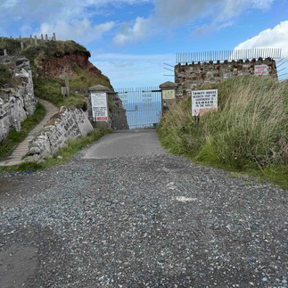
Coming into Hartland Quay I passed some ruins - not sure what they were, but they were located on a windswept landscape


Here is a pano of the coast as I get to the last bluff before Hartland Quay

I made it to the Hartland Quay Hotel just as the first rain drops started to fall. This Hotel has a shipwreck museum which I am holding for next time. This area is known for its many shipwrecks. This porthole is from a downed ship and has scratches from the rocks still showing on the glass


While waiting for Steve and Mel (and Paddy, their dog), I ended up having 2(!) pints of local Rattler cider while waiting for Steve/Mel who got lost due to all the detours. This is a lot for me... The hotel has no quaint signage - this was all I could find with the name of the hotel.


There were some stranded walkers. Their reserved taxi got a puncture and no others were available due to the bad weather. Steve/Mel offered to take them 30 minutes the other way (for £40) and then we went back to Bideford from there.
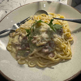
I went out to the recommended Italian for some pasta, I was rather hungry after not eating much for the day.

So this ends the hiking portion of this trip. The next trip section will take me from Hartland Quay to Bude, one of the most challenging portions of the entire SW Coast Path.

Ummmmmm......I dont think the US had B52's in the 2nd WW - probably would have been a game changer :-)