March 28,2023 from the itinerary: Base Torres. High mountain ascent. Expert level. 14.7 miles. Full day. 7 hours. Elevation gain: 3783 feet. This exploration goes through one of the most iconic sectors of the W. We travel by van to the Cerro Paine ranch where we begin our ascent to the base of the Torres del Paine. At the top, we can appreciate the magnitude of the granite towers and the lagoon at our feet. We return by the same road.


Actual mileage and elevation: 15.4 miles and 4060 elevation gain. 8 hours (with lunch and breaks was 9.17 hours). At the end of this day we will have covered 2 "prongs" of the "W".
We seem to be getting up earlier and earlier. This morning we had to be dressed, ready and breakfasted by 7:05 for a 7:15 departure. It was a struggle since I was up at 4am researching the hike and making sure there was no rock scrambling. To make matters more exciting it had snowed overnight. When we met our guide Raul he suggested I wear long underwear bottoms because it was very cold, so I ran back to get them. We prepared with multiple layers: 3 for legs, about 6 for top and 3 pair of gloves.
On this hike there were ourselves and a family of 6 (parents of 4 teenage boys). We were wondering how they could afford this trip as we decided it would cost them about $50k, plus airfare, for the week. Anyway, we walked out to the van and saw the local fox family - no pictures unfortunately. It was nice to see some wildlife as this has been a bit of a disappointment to date at this site. We all piled into the van and drove 50 minutes to the visitor center. There was a snow fall during the night and for most of the way we drove seeing snow on the landscape. From the top of Torres we saw head torches from people waiting for the sunrise, which came along the way.


After about 50 minutes we got to the visitor's center where the van dropped us and we had a stretch. It was cold! and off we went. The first 2 miles were rather flat and we walked by the Torres del Paine hotel - had we been able to park there we would have chopped off 4 miles of the walk, something that we would have appreciated on the return.

After we crossed the bridge and got to the actual start of the hike, we were caught up by another guide and two other Explora guests. They (these two and the family of 6) set off at a much faster pace and this set us (Chris and I) and our guide Raul free to go at our own much slower pace. This pace turned out to be an average and normal one for this hike....
The first part of this hike is mostly uphill and rather steep, gaining about 1900 feet over about 3-4 miles when you reach Windy Pass. Everything had a blanket of snow and was either white or black.


After some photos we continued on, now mostly downhill, to the end of the first phase - the Refugio Chileno - where we stopped for a snack before starting the second phase of the trail. We were met by a Rufous-collared Sparrow


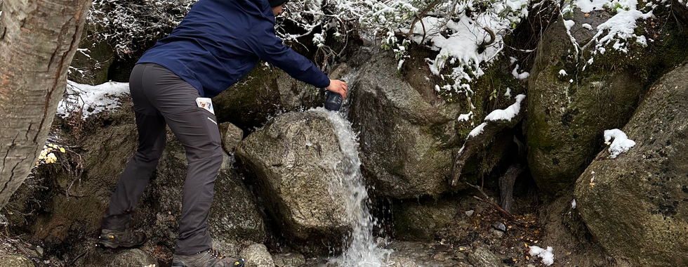
The next phase of the hike was through a forest section along a river. The elevation gain was less here, but still present. This was magical because the snow covered the trees with changing leaves and it looked like a fairyland. Occasionally, the snow would fall off the branches in a big plop as we walked underneath. The guide filled the water bottle using glacial water. We crossed the river and several rivers to the next stopping point - the base of the morraine - which was about 1.5 miles later.


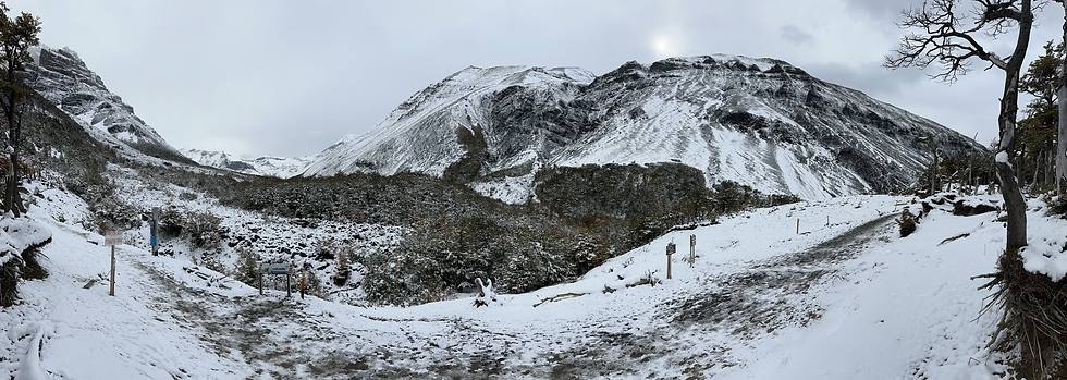
Now we started the third phase and most steep - up through the morraine to the lake at the base of the towers. There was no rock scrambling, but plenty of stones to step up. On top of everything else the snow on the ground was rather slushy from so many people on the path and the temperature dipped, so the slush started to freeze making the rock walking especially treacherous. We were within a stones throw of the end point and the path was diverted to wind around the top of the hill as a "safety" measure - this was probably the most dangerous part of the hike - extremely slick. It started to snow. We finally got to the top and had to go down to the lake area. This part of the hike had compacted snow and we started to slide on it - no traction. Needless to say, we were relieved to find our spot for a picnic lunch and change into warmer/dryer clothing which was out of the wind and snow.
At the top we met the rest of the hikers from the Explora already coming down. They reached the top about an hour before we did....We were thankful at least there was some view of the towers,


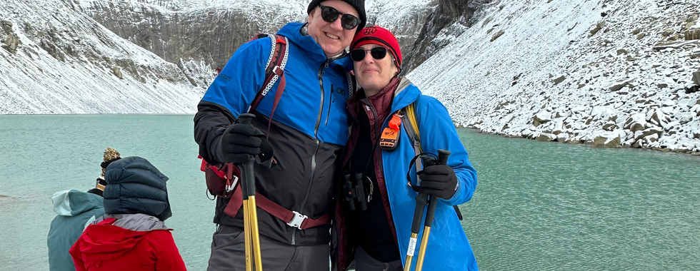
After a nice rest and photos we started down. We were rather concerned about how difficult this was now going to be only to find out the temperature rose during lunch and the majority of the ice/snow had melted. Indeed about 15 minutes down the sun came out.


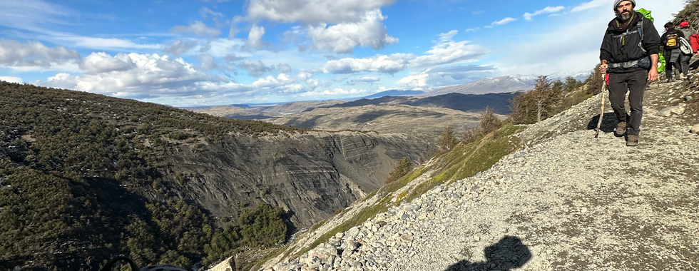


This is a popular route and many people were coming down, so sometimes it seemed like a parade. The parade stopped sometimes to let people come up, so a flavor of "hurry up and wait".
Windy Pass going up and coming down


The forest was completely different on the return. There was no snow and it was rather muddy now. It was 4:30 by the time we got to the Chilean Refuge and we decided to continue without a stop - there was still a 90 minute journey to the van. By the time we got the Windy Pass we just wanted to finish - especially because we saw a dark wall of clouds heading our way.
nothing much further to report except it started to get windy and quite cold. The last 2 miles were really a drag. The actual mileage was about 3 miles longer and elevation higher, than mentioned in the guide book....
Dinner was well deserved, but no photos...:(
And another hike, the W, on my list of "to do before you die" can be checked off the list.
Kommentare