Westward Ho! To Clovely
- Oct 7, 2024
- 5 min read
October 6, 2024, from the Itinerary: Follow the SW Coast path along the ocean. Here are some highlights:
The views from the top of Cornborough and Abbotsham Cliffs above Westward Ho! looking northwards to Braunton Sands and Baggy Point.
Having a picnic by the stream at Peppercombe. There are many woodland plants inhabiting Peppercombe Valley, such as sweet woodruff and wood millet. If you feel like exploring the valley further you will find betony, orchids and ragged robbin, well-loved by butterflies.
Although prominently marked on the map there are now few visible signs of the Iron Age hill fort known as Peppercombe Castle. But about 2 miles further along, just before you enter the woods and start the steep descent down to the village, the Path passes through the remains of Bucks Mills defensive earthworks.
Views of Bideford Bay and Lundy from Buck’s Mill Cove. Here you will find projecting from the cliff face the remains of a limekiln which is said to have operated from 1760-1860, using limestone and coal imported from South Wales.
Winding through the ancient, wild oakwoods beyond Peppercombe and emerging into fields on the cliff tops with wonderful views of the bay.
Walking The Hobby Drive, built in the early 19th century, with glimpses through the trees of Bideford Bay and Clovelly harbour. Clovelly’s woodlands are nationally important for lichens and there are over 250 species here.
Walking the beautiful steep and cobbled streets of Clovelly and resting at the look-out to watch the boats and occasional falcon go by. In 'A Message from the Sea' (1892) by Charles Dickens the village of Clovelly is called Steepways: “The village was built sheer up the face of a steep and lofty cliff. There was no road in it, there was no wheeled vehicle in it, there was not a level yard in it … No two houses in the village were alike, in chimney, size, shape, door, window, gable, roof-tree, anything
Anticipated activity stats: 11.2 miles, 1,650 feet elevation gain and 1,250 elevation decrease
Actual activity stats: 11.7 miles, 1,850 elevation increase, 1,550 elevation decrease
Weather: Highs in the 60s with storms in the afternoon - a chance of thunderstorms
Bless his heart, Steve offered to drive me to Westward Ho! To start my hike and I took him up on the offer. It was another wonderful breakfast


And we got to the drop off point at 8am. There was no rain yet and the light was beautiful on the ocean. The seagulls raided the garbage.


Here’s a better view of Lundy Island a bit later in the day.


The entire day was along the coast and as I was leaving Westward Ho!, I noticed a sign telling me that Kipling went to school nearby after he was brought back from India. There were quotations from his book in the sidewalk as I was leaving town.


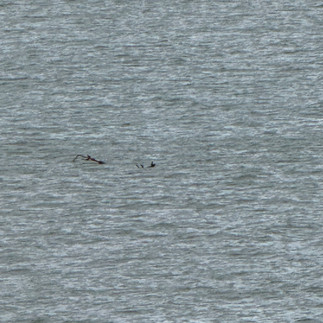
I was able to see some dolphins in the ocean, but couldn’t get a photo. I was able to get, what I thought was a sea lion, by turned out to be a branch…

There were beach huts lining the walkway and buni found his favorite.


As I got to the edge of town I met an older lady walking her dog who pointed out, Bush’’s Mills, Clovelly and Hartland Point.


Heartland Point is close to my finishing point tomorrow. Seeing Clovelly, I wasn’t sure if it was a good thing to be able to see the end of today’s journey, or not….Then she told me her life story and I was a bit relieved when her friend called her from New Zealand and I was able to get on with my walk.
The walk’s beginning was exposed cliff side and undulating.


As it got to be about 9am I realized that the path was getting quite muddy and I slowed down a lot to avoid slipping. This got especially difficult on some of the steep uphills which I had to take quite slowly


I realized this mud meant I was going to arrive after my time goal of 2pm. Thankfully, I only missed it by an hour.
Some more beautiful views along the way


There were pheasant and partridge everywhere and sometimes they ran ahead of me on the trail.


There were also some amazingly big mushrooms. These were 5+ inches across.


Supposedly Abbottsham Cliff had long horn steer, but I didn’t see any of them
There were some quite steep and slippery downhills - one was to the beach at Pepperidge - with equally slippery return uphills.


At sometime between 11 am and noon the rain started. There was nowhere to sit down to put on my rain pants, so I put on my rain coat and got the rain cover on my pack. The rain actually felt nice because I was so hot.
The rain became quite heavy. So heavy that some of the stair portions were like waterfalls.


There was no place to get food between Westward Ho! and Clovelly. Frankly, I wasn’t even hungry, even though I brought some fruit and snack bars to tide me over. It was probably the extra protein provided by the fly that flew into my mouth…
The little village of Bush’s Mill had more houses than I thought, but nowhere to get a cup of tea, so I soldiered on. The lady earlier in the day mentioned the walk out of this village was hard. I was really anticipating it because the earlier hills of Green Cliff, and walking down/up to/from Pepperidge Beach were so challenging. It turned out this wasn’t bad at all, except it was raining SO HARD at this point. I was getting quite soaked and it was already too late to put on rain pants. I felt my feet get wet, but I was still warm.


Another few miles and I was on a road instead of a mud track and there were even more pheasants running ahead of me. By this point I was about 2 miles outside of Clovelly, soaked through and getting cold.


I was so pleased to get to Clovelly and slowly work down the cobblestone street (it was very slippery), to my hotel - The New Inn.


Thankfully there were enough heated things to get my clothes drying and I got some blue roll from the Inn Keeper to stuff inside the boots. Here’s a shot of my insoles that actually had standing water in them.


I did a quick recce of the town which was unfortunately already closed - it was Sunday and very rainy.


I came back to the pub at The New Inn and had a slice of cake and tea to warm up. There was a very nice and very wet cat that I did not allow on my table….


Then in for a bath and a rest.
Here is some history of Clovelly:
Inhabited since the Iron Age as noted by the hillfort at Windbury Head NW of the village. William the Conqueror “acquired” the Manor of Clovelly after the Norman conquest in 1066. The village is listed in The Domesday Book (Clovelie). The village was gifted to William the Conqueror’s wife, Matilda of Flanders.
Starting in the late 14th century the Cary Family became lords of the manor for 400 years. The Cary Family turned the village from farming to fishing and made a safe harbour port for ships along this stretch of the Devon Coast (between Appledore and Boscastle).
In 1703 the Clovely Estate was acquired by the Hamlyn family who manage the estate to this day.
The Main Street is closed to vehicular traffic and deliveries are made by sledge (there’s a sledge next to this fountain). Garbage is also pulled down the hill to a vehicle at the harbour. Casualties are taken to the harbour on a sedan chair to be collected by an ambulance.


The village is very picturesque and was used as a set for several movies and adverts, including: Sense and Sensibility, The Guernsey Literary and Potato Peel Pie Society, Treasure Island (1990 - TV movie) and several episodes of The Long Chase, to name a few.
LOL - older lady and the fly!